Italy is the perfect country to visit by e-bike, pedaling between villages, archaeological sites, historic streets, monuments, rivers and hills.
The objective is to offer 10 safe and quality national cycle routes, capable of enhancing the historical, cultural and environmental itineraries along the entire peninsula.
This project, called "EuroVelo" will be made up of cycle routes that have been identified following proposals from the territories and sector associations and will reach approximately 6,000 kilometres.
They are partly existing and practicable routes and the project envisages either their completion or their entire construction and will be completely dedicated to vehicles without engines, respectful of the environment and will have ad hoc signs and services.
Let's get to know them in more detail:
- Ciclovia del Sole: this is approximately 300 km long and is part of the Ciclopista del Sole project. A first section, the one from Brennero to Verona and Lake Garda, has already been completed while the next stage aims to reach the capital .
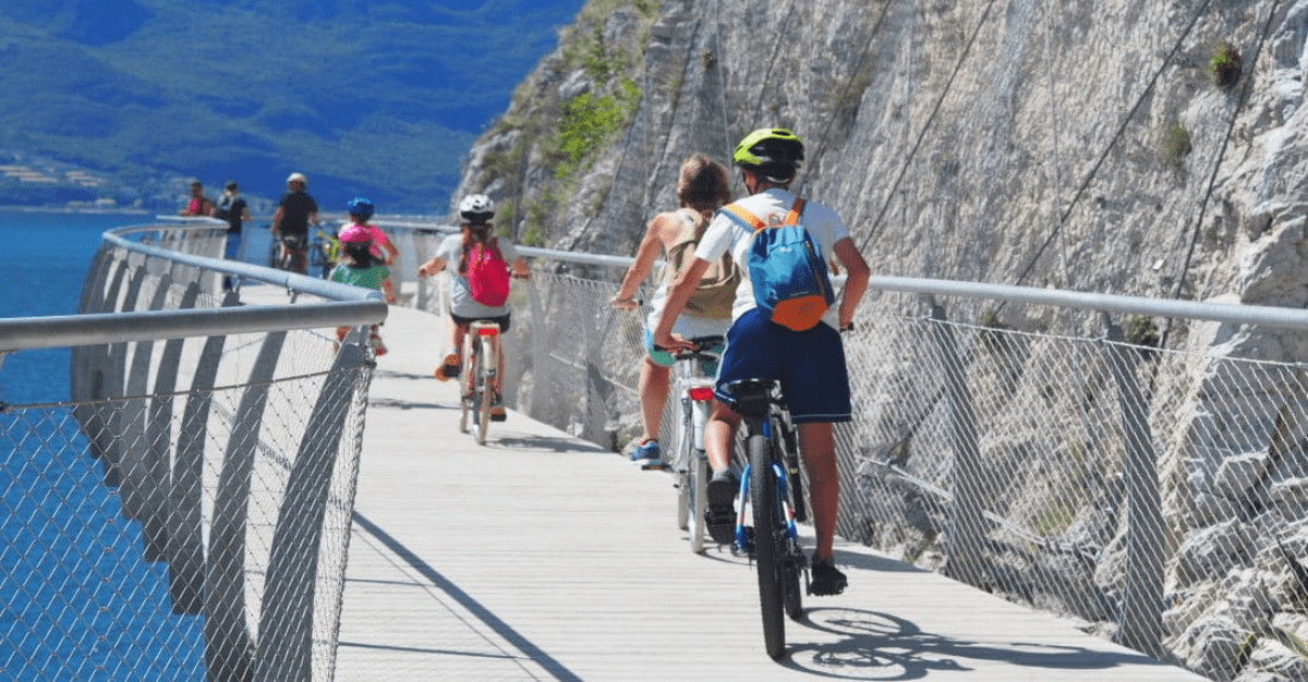
- Garda cycle path: this route connects with itinerary 7 of the EuroVelo European cycle network and consists of a 140 km circular itinerary along the shores of Lake Garda, involving the autonomous province of Trento and the regions of Veneto and Lombardy.
- Ven-To cycle path: drawn up by the Department of Architecture and Planning of the Polytechnic of Milan, it consists of a 680 km cycle route that runs along the Po river and which aims to connect Venice to Turin crossing 121 municipalities. This would be the longest infrastructure for cycle tourism in Italy and southern Europe, and is part of the Eurovelo 8 route in connection with Eurovelo 5 and Eurovelo 7.
- Venice – Lignano Sabbiadoro – Trieste cycle route: this itinerary will be 150 km long and is part of the Eurovelo 8 backbone and the Bicitalia Itinerary 6. It is located between Friuli Venezia Giulia and Veneto and constitutes a natural bridge towards the Balkans.
- Adriatic Cycle Route: from Venice to the Gargano it crosses the regions of Veneto, Emilia Romagna, Marche, Abruzzo and Molise for approximately 700 kilometres. The route coincides with branch 6 of the national cycle network proposed by FIAB. The estimated route is internally coastal and runs parallel to the E55 route.
- Tirrenica cycle route: this cycle route goes from Ventimiglia to Rome and is approximately 1200 km long, of which 700 are already passable and cross Liguria, Tuscany and Lazio. The Ligurian part is 460 km long and includes archaeological sites, characteristic villages and protected natural areas. The Tuscan part is approximately 560 km and touches archaeological sites, Versilia, the Cosa degli Etruschi and cities of art such as Pisa, as well as various protected natural areas. While in Lazio the route is approximately 200 km and involves sites such as Tarquinia, the Roman Coast State Reserve and the Palude di Torre Flavia natural monument.
- GRAB cycle path: the Gran Raccordo Anulare delle Bici project consists of a 44 kilometer cycle/pedestrian ring that extends within the city of Rome. This cycle route starts from ancient Rome and the Appia Antica and reaches the structures of Zaha Hadid and Renzo Piano, the street art of Quadraro and Torpignattara, combining the great classics such as the Colosseum, San Pietro and Trastevere.
- Apulian Aqueduct cycle path: 500 km of route that crosses 3 regions and was created to make a greenway that runs along the main canal of the Apulian Aqueduct accessible to the public and accessible by bicycle.
- Cycle route of Magna Graecia: with an extension of approximately 1000 km, this itinerary embraces Basilicata, Calabria and Sicily. It will be built mainly on service roads starting from Metapondo up to the city of Reggio Calabria to go up the Tyrrhenian ridge arriving in Maratea, in Basilicata, to then connect to Reggio Calabria and arrive in the Sicilian stretch, connecting Messina with Catania, Syracuse and Pachino and finishing in Pozzallo.
- Sardinia cycle path: 1230 km long, it can be divided into geographical directions which include the western one which goes from Alghero to Cagliari and the eastern one which from Santa Teresa di Gallura to Cagliari. Then there will be the itinerary that connects Porto Torres and Santa Teresa di Gallura and the other that goes from Dorgali to Macomer, crossing Nuoto, in the center of the island.